


Descripción de Trainsity Kuala Lumpur LRT KTM
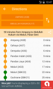
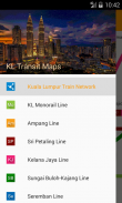
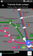
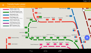
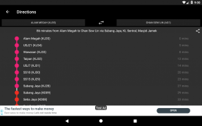
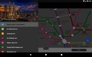
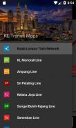
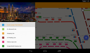
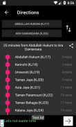
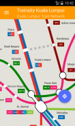
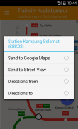
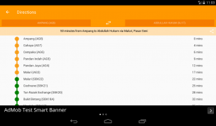
Find your way around the city of Kuala Lumpur using the high resolution vector maps of the KTM Komuter lines, RapidKL lines, and KLIA Express Rail Link lines. The maps have small file size footprints but with many levels of zoom and can work offline without connecting to the Internet. Users can click the train station labels to open Google Maps or Street View, where they can use all the functions of the Google apps to visualize the surrounding area and/or perform routing for directions. There is also an offline function to calculate the best way to travel from a station to another station with a direction breakdown and timings (which may vary from the actual travelling time).</div> <div jsname="WJz9Hc" style="display:none">Encuentre su camino alrededor de la ciudad de Kuala Lumpur utilizando los mapas vectoriales de alta resolución de las líneas KTM Komuter, líneas RapidKL y líneas KLIA expreso Rail Link. Los mapas tienen pequeñas huellas tamaño de archivo, pero con muchos niveles de zoom y pueden trabajar sin conexión y sin conexión a Internet. Los usuarios pueden hacer clic en las etiquetas de la estación de tren para abrir Google Maps o Street View, en el que puedan utilizar todas las funciones de las aplicaciones de Google para visualizar los alrededores y / o realizar el enrutamiento de direcciones. También hay una función fuera de línea para calcular la mejor manera de viajar desde una estación a otra estación con un desglose dirección y los tiempos (que puede variar desde el tiempo de viaje actual).</div> <div class="show-more-end">
Trainsity Kuala Lumpur LRT KTM - Versión 2.7.200
(22-11-2023)Trainsity Kuala Lumpur LRT KTM - Información de APK
Version de la app: 2.7.200Paquete: com.dom925.trainsity.kualalumpurApps en la misma categoría
Quizá también te interese...


